Professional Endurance Platform: Mapping and Inspection in Remote Terrain
This rugged, multi-rotor aerial system is specifically engineered for critical inspection and high-fidelity mapping missions in the world's most inaccessible and hostile environments, delivering reliable performance from high-altitude plateaus to arid mountain ranges.
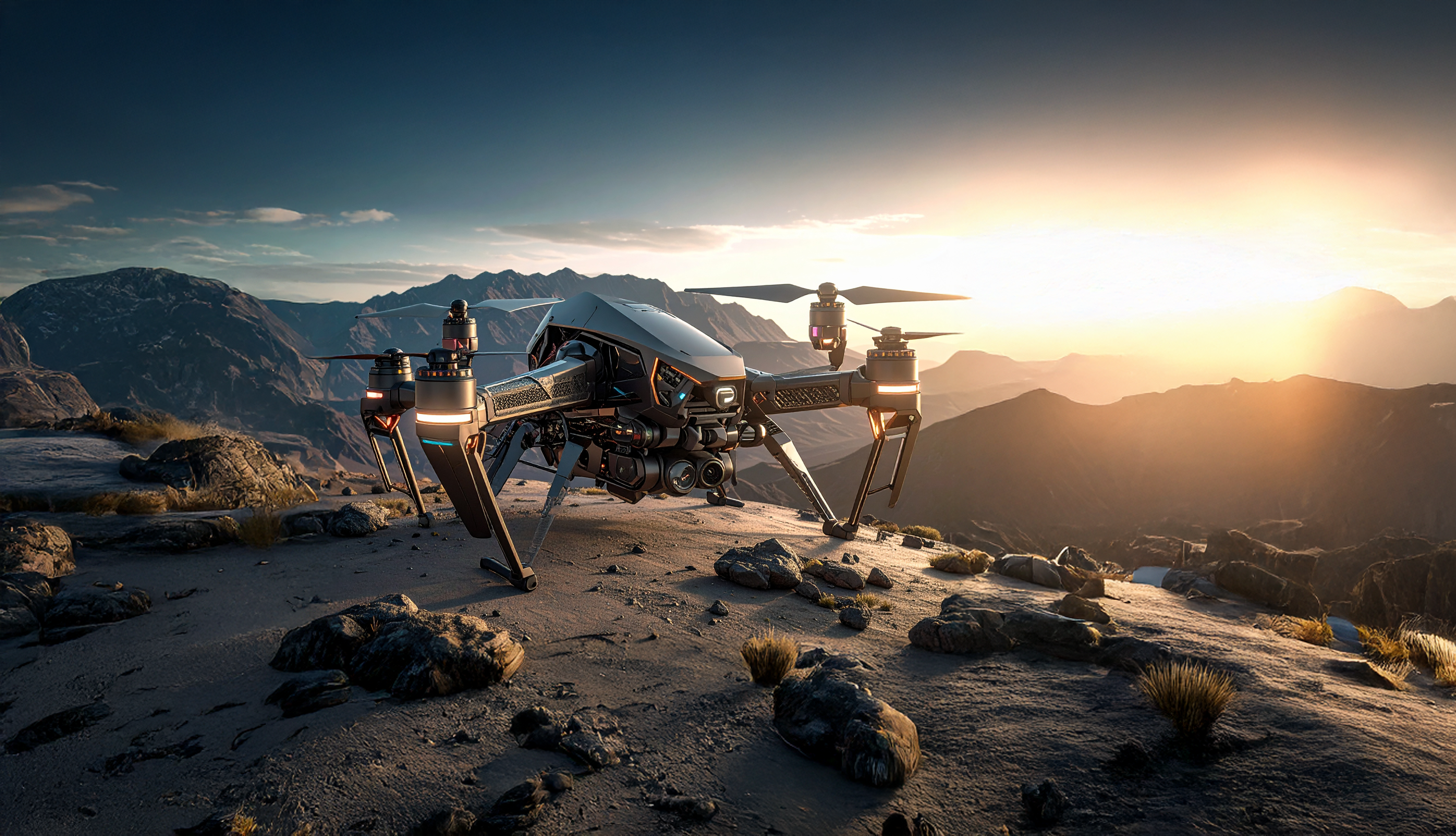

In the challenging environments of high-altitude deserts and rugged, remote mountain ranges, such as the formidable landscape visible at dawn or dusk, reliable data acquisition is paramount. This specialized, heavy-duty multi-rotor platform represents the cutting edge of industrial aerial technology, designed explicitly to overcome severe geographic and atmospheric limitations. It is engineered not just to fly, but to operate autonomously for extended periods, providing critical, high-fidelity mapping and inspection services where traditional manned aircraft or human surveyors cannot safely or economically reach. This capability positions the drone as an essential tool for geoscience, infrastructure assessment, and resource management in the world’s most demanding territories, ensuring data integrity regardless of environmental hostility.
All-Terrain Adaptability and Structural Integrity
The core design philosophy of this platform emphasizes uncompromising resilience, visibly demonstrated by its wide, aggressive stance optimized for uneven surfaces. The central chassis and boom arms are constructed from aerospace-grade aluminum and carbon fiber composites, offering maximum stiffness and vibration damping critical for high-resolution imaging. The prominent, heavy-duty landing gear features an Articulated All-Terrain Stance (AATS) system. This system allows the drone to safely launch and recover from slopes, loose rock, and uneven ground—a necessity in the kind of mountainous environments pictured. The specialized shock absorption within the AATS protects the internal components and sensitive sensor gimbal from impact during rough field landings.

All critical electronic components are housed in sealed compartments, providing superior protection against dust, sand intrusion, and moisture—environmental hazards common in remote deployment zones. This extreme robustness translates directly into high operational uptime and minimized field maintenance requirements.
Key Design Features:
- Chassis Material: Reinforced Carbon/Aluminum Alloy.
- Landing System: Articulated All-Terrain Stance (AATS) with integrated dampeners.
- Environmental Sealing: IP55 rated for dust and water resistance.
- Propulsion: High-efficiency, dust-resistant motors for reliable lift in thin air.
Advanced Sensor Fusion for Geosciences
Positioned beneath the central body is a highly integrated, multi-sensor payload bay, designed for geological and civil engineering data acquisition. The visible suite combines three core technologies for comprehensive environmental mapping:
High-Resolution Optical and Thermal Imaging: The primary gimbal carries a cinema-grade optical camera, capable of 6K resolution, providing granular detail for structural analysis and photogrammetry. This is paired with a sensitive thermal camera that detects minute temperature variances, essential for identifying heat leakage, subsurface anomalies, or searching for subjects during low-light conditions (such as the sunrise/sunset environment shown).
Precision Lidar Scanning: Integrated Lidar technology generates dense, accurate point cloud data, vital for creating centimeter-level precise 3D models of complex terrain, mining operations, or remote infrastructure. In rocky and uneven environments, Lidar provides accurate elevation maps that traditional visual methods cannot match, particularly where shadows are long and distorting, as often occurs at sunrise or sunset.
The seamless integration of Lidar mapping with visual and thermal intelligence provides operators with a three-dimensional, multi-layered understanding of the terrain, enabling informed decision-making regardless of lighting or visibility.
Long-Range Autonomy and Mission Reliability
This platform is built for independence. Its onboard Flight Management System (FMS) allows for the pre-planning and execution of complex missions hundreds of kilometers from the operator. The FMS manages flight patterns to maximize battery life, intelligently navigates challenging mountain passes, and uses proprietary algorithms to counteract strong winds and unpredictable air currents. The drone maintains a secure, encrypted telemetry link via redundant communication channels, ensuring mission data is transmitted reliably even from remote positions deep within mountain ranges. This reliability makes the platform an indispensable asset for large-scale infrastructure monitoring, mineral exploration, and critical asset security in remote regions.

